1.067.663
kiadvánnyal nyújtjuk Magyarország legnagyobb antikvár könyv-kínálatát

VISSZA
A TETEJÉRE
JAVASLATOKÉszre-
vételek
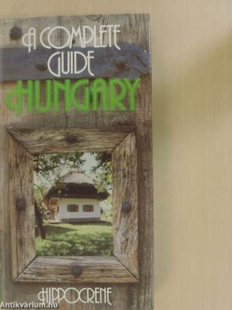
A Complete Guide Hungary
Magyarország/A Complete Guide/Útikalauz
| Kiadó: | Hippocrene Books, Inc. |
|---|---|
| Kiadás helye: | New York |
| Kiadás éve: | |
| Kötés típusa: | Fűzött keménykötés |
| Oldalszám: | 294 oldal |
| Sorozatcím: | |
| Kötetszám: | |
| Nyelv: | Angol |
| Méret: | 25 cm x 13 cm |
| ISBN: | 0-87052-592-1 |
| Megjegyzés: | Fekete-fehér ábrákkal, térképekkel illusztrálva. |
naponta értesítjük a beérkező friss
kiadványokról
naponta értesítjük a beérkező friss
kiadványokról
Előszó
Hungary is situated in Central Europe at approximately an equal distance from the Equator and the North Pole and lies between 16° and 23° longitude East and 45° 48' and 48° 40' latitude North.... TovábbElőszó
Hungary is situated in Central Europe at approximately an equal distance from the Equator and the North Pole and lies between 16° and 23° longitude East and 45° 48' and 48° 40' latitude North. Occupying an area of 93,032 sq.km, Hungary makes up less than 1% of all Europe and ranks sixteenth in size among the European countries. It extends 528 km from east to west and 268 km from north to south. SURFACEOFTHELAND Almost two-thirds of the territory of Hungary consists of fertile plains no more than 200 m above sea level, and barely 2% of the land lies 400 m above sea level. The country's highest peak, Kékestető (1,015 m), is in the Mátra Mountains, the lowest point (78 m) is near Szeged. Hungary is divided into three large regions: Transdanubia (Dunántúl), the Great Plain (Alföld) and Northern Hungary. The Danube Bend (Duna-kanyar) is situated atthe point where the three large regions of Hungary meet, forming a harmonious unity. HYDROGRAPHY Hungary belongs to the drainage basin of Europe's second longest river, the Danube. The 417 km long Hungárián section ofthe river iscompletely navigable (140 kilometres of this section form part of the Hungarian-Czechoslovak bordér). The 579 km Hungárián section ofthe Tisza is likewise mostly navigable. Spreading over an area of 596 sq. km, Laké Balaton is the largest laké of Central and Western Europe. Its length is 77 km, its average width is 5 km, and its maximum width is 14 km, the narrowest section, between Tihany and Szántód, is only 1.5 km. Its average depth is between 2 and 3 m, and its deepest point is 12.4m. Laké Velence,the country's second largest laké (27 sq. km), lies between Budapest and the Balaton. Hungary is rich in mineral and medicinái waters. Today there are about 500 natural springs and newer ones are continually being discovered and put into use. CLIMATE Hungary is situated in the temperate zone, with both moderate maritime and mildMediterraneanaircurrentsinfluencingitsclimate.Temperaturesabove30°C may occur in July and August but generally do not last very long. The average temperature during these months is between 20° and 21°C. January is the coldest month, but eventhen the average temperaturedoes not fali below-1°C. Hungary has a rather low rainfall, which exceeds an annual average of 600 mm only in Transdanubia. Nevertheless, sudden downpours and storms are frequent during the summer. The number of sunny hours is high, exceeding 2,000 hours per annum in somé regions of the country. July and August are the two sunniest months, with almost 300 hours of sunshine. PLÁNT AND ANIMAL LIFE There are 2,165 flowering-plant species in Hungary. Field crops cover much of the land, 13.6% of which is forests, mostly oak and beech (only 6% are coniferous). There are 32,000 animal species in Hungary, including 450 vertebrates. POPULATION The population of Hungary is 10,590,000. Hungary is one of the more densely populated countries ofthe Continent with 114 people per sq.km. The population ofthe capital is 2,115,000. There are eight cities besides Budapest with a population of over 100,000 (Miskolc, Debrecen, Szeged, Pécs, Győr, Nyíregyháza, Kecskemét and Székesfehérvár). In addition to the Hungárián population, Germán, Slovak, South Slav and VisszaTartalom
CONTENTSHUNGARY: A LITTLE BACKGROUND
HUNGARY: THE LAND AND ITS PEOPLE 11
A BRIEF HISTORY 12
A CHRONOLOGICAL TABLE 18
A SHORT HISTORY OF HUNGÁRIÁN CIVILIZATION 19
SOMÉ PROMINENT FIGURES OF CULTURE AND HISTORY . 26
A DETAILED GUIDE
Budapest 31
THE HISTORY OF THE CITY 31
BUDA 36
The Castle District and the Royal Palace 36
Víziváros, Óbuda, Margaret Island, Aquincum and the
Római-part 47
Gellért Hill and surroundings. The southern section of
Buda 57
The Buda Hills 59
PEST 60
The Inner City 60
The Kiskörút 69
The Nagykörút 73
Andrássy út and the City Park 75
Rákóczi út 80
From Újpest to Csepel 82
The Danube Bend 83
THE RIGHT BANK OF THE DANUBE 84
Szentendre 84
Visegrád 88
Esztergom 92
THE LEFT BANK OF THE DANUBE 98
Vác 100
Transdanubia 105
NORTHERN TRANSDANUBIA 108
Tatabánya 109
Tata 109
Győr 112
Mosonmagyaróvár 117
WESTERN TRANSDANUBIA 118
Sopron 118
Kőszeg 124
Szombathely 126
Laké Balaton
THE NORTHERN SHORE ^
Balatonakarattya 15g
Balatonkenese 15g
Balatonfűzfö 16Q
Balatonalmádi ^
Balatonfüred 166
Nagyvázsony
Tihany r/2
Balatonszepezd
Révfülöp 172
Balatonrendes
Badacsony
Tapolca
Sümeg
Keszthely
Hévíz
THE SOUTHERN SHORE ""
Siófok
Zamárdi-Szántód ™
Balatonföldvár 18;
1 87
Balatonszárszó
Balatonszemes
Boglárlelle-Balatonlelle 188
Boglárlelle-Balatonboglár 189
Fonyód 190
Balatonfenyves 191
Balatonmáriafürdő
Balatonberény 192
THE LITTLE BALATON 192
The Great Plain 193
THE REGION BETWEEN THE DANUBE AND THE TISZA ... 193
Kalocsa 194
Baja 197
Kiskunhalas 198
Kecskemét 199
Nagykőrös 202
Kiskunfélegyháza 202
Szentes 203
Szeged 204
Cegléd 209
Jászberény 209
Szolnok 210
THE REGION BEYOND THE TISZA 211
Makó 212
Hódmezővásárhely 213
Orosháza 214
Békéscsaba 214
Gyula 215
Szarvas 216
Karcag 218
The Hajdúság 218
Hajdúszoboszló 219
Debrecen 220
The Hortobágy 223
The Nyírség 226
Nyíregyháza 226
Northern Hungary 229
THE CSERHÁT MOUNTAIN RANGÉ 229
Balassagyarmat 229
Salgótarján 234
THE MÁTRA MOUNTAIN RANGÉ 234
Gyöngyös 235
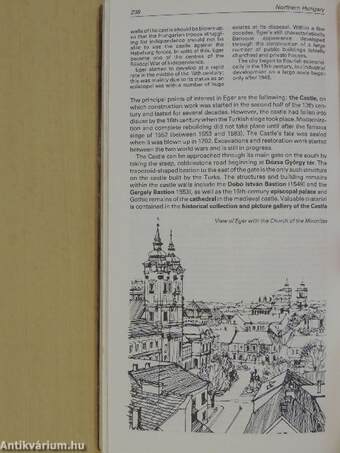
Eger 237
THE BÜKK MOUNTAIN RANGÉ 242
Miskolc 244
Kazincbarcika 249
Ózd 250
THE AGGTELEK MOUNTAIN RANGÉ 250
Aggtelek-Jósvafő 250
THE ZEMPLÉN MOUNTAIN RANGÉ 252
Szerencs 253
TOKAJ-HEGYALJA 254
Tokaj 256
Sárospatak 257
Sátoraljaújhely 260
PRACTICAL INFORMATION
TRAVEL INFORMATION 263
FORMALITIES 263
Visas 263
Customs concessions and currency regulations ^
Car papers 264
Health regulations 264
TRAVEL TO HUNGARY 265
TRANSPORT 265
Motoring 266
Railways 266
Long-distance buses 266
Air travel 266
' 267
Public transport
ACCOMMODATION 267
EATING OUT 267
Hungárián cuisine 267
What to drink 268
Csárda-inns and taverns 269
Confectioner's 269
Mealtimes and eating habits 269
SIGHTSEEING 269
NATIONAL HOLIDAYS 270
REGULAR EVENTS 270
HUNTING, ANGLING, RIDING 271
SHOPPING 271
POSTAL SERVICES 273
NEWSPAPERS 273
MEDICAL TREATMENT 273
INSURANCE 273
Appendix 274
TOURIST DIRECTORY 274
DIRECTORY OF PLACE NAMES 292


