1.067.669
kiadvánnyal nyújtjuk Magyarország legnagyobb antikvár könyv-kínálatát

VISSZA
A TETEJÉRE
JAVASLATOKÉszre-
vételek
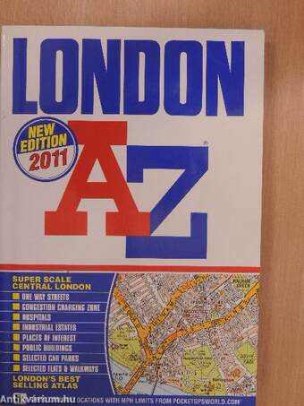
London A-Z
| Kiadó: | Geographers' A-Z Map Co., Ltd. |
|---|---|
| Kiadás helye: | Sevenoaks |
| Kiadás éve: | |
| Kötés típusa: | Ragasztott papírkötés |
| Oldalszám: | 446 oldal |
| Sorozatcím: | |
| Kötetszám: | |
| Nyelv: | Angol |
| Méret: | 19 cm x 13 cm |
| ISBN: | 978-1-84348-602-2 |
| Megjegyzés: | Színes illusztrációkkal, térképekkel. |
naponta értesítjük a beérkező friss
kiadványokról
naponta értesítjük a beérkező friss
kiadványokról
Előszó
Geographers' A-Z Map Company Ltd.
Fairfield Road, Borough Green, Sevenoaks, Kent TN15 8PP
Telephone : 01732 781000 (Enquiries & Trade Sales)
01732 783422 (Retail Sales)
www.a-zmaps.co.uk... Tovább
Előszó
Geographers' A-Z Map Company Ltd.
Fairfield Road, Borough Green, Sevenoaks, Kent TN15 8PP
Telephone : 01732 781000 (Enquiries & Trade Sales)
01732 783422 (Retail Sales)
www.a-zmaps.co.uk
Edition 9 2011
© Copyright of Geographers' A-Z Map Company Limited
No reproduction by any method whatsoever of any part of this publication is
permitted without the prior consent of the copyright owners.
Every possible care has been taken to ensure that, to the best of our
knowledge, the information contained in this atlas is accurate at the date of
publication. However, we cannot warrant that our work is entirely error free and
whilst we would be grateful to learn of any inaccuracies, we do not accept any
responsibility for loss or damage resulting from reliance on information
contained within this publication.
The representation on the maps of a road, track or footpath is no evidence of
the existence of a right of way.
The Grid on this map is the National Grid taken from Ordnance Survey
mapping with the permission of the Controller of Her Majesty's Stationery Office.
Ordnance
Survey product includes mapping data licensed from Ordnance Survey®
with the permission of the Controller of Her Majesty's Stationery Office.
© Crown Copyright 2010. All rights reserved. Licence Number 100017302
Safety camera information supplied by www.PocketGPSWorld.com
Speed Camera Location Database Copyright 2010 © PocketGPSWorld.com
H
Safety camera locations are publicised by the Safer Roads Partnership
which operates them in order to encourage drivers to comply with speed limits
at these sites. It is the drivers absolute responsibility to be aware of and to
adhere to speed limits at all times.
By showing this safety camera information it is the intention of
Geographers' A-Z Map Company Ltd., to encourage safe driving and
greater awareness of speed limits and vehicle speed.
Data accurate at time of printing.
The publishers are deeply grateful for the ready co-operation and valuable help
given to them in the production of this atlas. They would like to record their
obligation to: The Engineers and Surveyors Departments and Planning Offices
of all the Local Authorities covered in this atlas, The Department for Transport,
Highways Agency, Transport for London, The Post Office, Police Authorities,
Fire Brigades, London 2012, Taxi Drivers, Members of the Public.
Printed and bound in the United Kingdom by Polestar Wheatons Ltd., Exeter.
An AtoZ Publication Vissza
Tartalom
CONTENTS
Congestion Charging Overview
and Information Inside Front Cover
Key to Map Pages
2-3
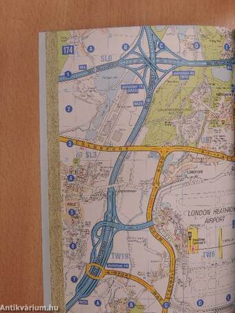
Super Scale Map Pages @ 53/4"to 1 mile 4-19
Map Pages @ approx. 3" to 1 mile
20-174
Index to Streets, Areas &
selected Places of Interest
175-432
Index to Hospitals etc. 433-438
Index to Stations 439-441
Railway Connections Map 442-443
Underground Railway Map 444-445
West End Theatres Map 446
REFERENCE
Motorway
A Road
Under Construction
Proposed
A2
B Road
B408
Dual Carriageway
One-way Street
Traffic flow on A Roads is also indicated
by a heavy line on the driver's left.
Junction Name
MARBLE ARCH!
Restricted Access
Pedestrianized Road
:tz
Track & Footpath
Residential Walkway
Congestion Charging Zone
Tunnel
Level Crossing
Railway
Stations: __
National Rail Network & Overground Ea
Docklands Light Railway mill
ii i _, a Super Scale
Underground Map Pages
Tunnel
London Tramlink ___
The boarding of Tramlink trams at stops may be Stop
limited to a single direction, indicated by the arrow.
Postcode Boundary — —--
Built-up Area
BANK
STREET
Map Continuation
Super Scale
Map Pages
Airport
Car Park (Selected) I
Church or Chapel t
Fire Station ¦
Hospital O
HoUSe Numbers (A 8. B Roads only) 51 22 13 48
Information Centre B
National Grid Reference 53Q
Park & Ride Bromley PW ¦
Police Station A
Post Office ?
River Bus Stop ©
Safety Camera with Speed Limit f58l (v) Fixed and long term road works cameras only ^^ Symbols do not indicate camera direction 0 „ Variable ' Speed Limit Speed Limit
Toilet: without facilities for the Disabled Y
with facilities for the Disabled V
Disabled facilities only V
Educational Establishment 1 1
Hospital or Healthcare Building 1 1
Industrial Building ?
Leisure or Recreational Facility Bl
Place of Interest i 1
Public Building HC'U
Shopping Centre or Market Rail
Other Selected Buildings ?
Témakörök
- Idegennyelv > Idegennyelvű könyvek > Angol > Műszaki
- Idegennyelv > Idegennyelvű könyvek > Angol > Útikönyvek
- Útikönyvek > Európa > Fővárosai
- Útikönyvek > Európa > Nyugat-Európa > Városai
- Útikönyvek > Idegennyelvű útikönyvek > Angol
- Útikönyvek > Térképek, atlaszok > Külföldi
- Útikönyvek > Természetjárás, túrák > Városnézés
- Műszaki > Közlekedés > Közúti
- Műszaki > Idegennyelv > Angol
- Műszaki > Közlekedés
- Műszaki


