1.067.104
kiadvánnyal nyújtjuk Magyarország legnagyobb antikvár könyv-kínálatát

VISSZA
A TETEJÉRE
JAVASLATOKÉszre-
vételek
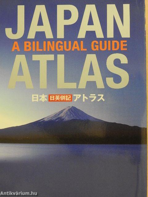
Japan Atlas
A bilingual guide
| Kiadó: | Kodansha International |
|---|---|
| Kiadás helye: | Tokió |
| Kiadás éve: | |
| Kötés típusa: | Varrott papírkötés |
| Oldalszám: | 127 oldal |
| Sorozatcím: | |
| Kötetszám: | |
| Nyelv: | Angol Japán |
| Méret: | 22 cm x 15 cm |
| ISBN: | 4-7700-3026-6 |
| Megjegyzés: | Színes térképekkel. |
naponta értesítjük a beérkező friss
kiadványokról
naponta értesítjük a beérkező friss
kiadványokról
Fülszöveg
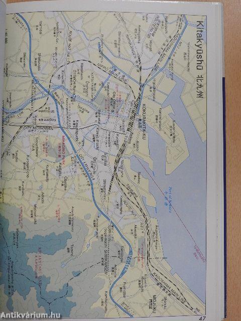
This atlas, the only one of its kind to provide place-names in both English and Japanese, is an invaluable tool for foreign residents of Japan, and an indispensable, handy companion for travelers. The atlas features:_
21 large-scale maps of the regions of Japan, including Greater Tokyo and the Kanto area, the Greater Osaka Area, and almost all of the officially registered Japanese cities, towns and villages. There has been a drastic change in recent years, following a government policy to have many cities, towns and villages merge. This atlas includes all the changes.
19 maps of major metropolitan areas, from Naha in Okinawa to Hiroshima, Kyoto, Nagoya, Tsukuba, Sapporo, and many others.
7 maps featuring notable tourist and resort areas, including Fuji-Hakone-lzu, Mara, Kamakura, IMikko, etc.
9 transportation maps, including road and intercity railway maps, Tokyo and Osaka subway and rail maps, and even major domestic airline routes.
12 thematic maps, indicating natural... Tovább
Fülszöveg
This atlas, the only one of its kind to provide place-names in both English and Japanese, is an invaluable tool for foreign residents of Japan, and an indispensable, handy companion for travelers. The atlas features:_
21 large-scale maps of the regions of Japan, including Greater Tokyo and the Kanto area, the Greater Osaka Area, and almost all of the officially registered Japanese cities, towns and villages. There has been a drastic change in recent years, following a government policy to have many cities, towns and villages merge. This atlas includes all the changes.
19 maps of major metropolitan areas, from Naha in Okinawa to Hiroshima, Kyoto, Nagoya, Tsukuba, Sapporo, and many others.
7 maps featuring notable tourist and resort areas, including Fuji-Hakone-lzu, Mara, Kamakura, IMikko, etc.
9 transportation maps, including road and intercity railway maps, Tokyo and Osaka subway and rail maps, and even major domestic airline routes.
12 thematic maps, indicating natural parks, world heritage, special historic spots, Ramsar convention entry areas, ceramic kiln areas, etc. A comprehensive index.
A list of embassies, consulates, and sister cities.
mi^^ua. -TKra^i^fgtsiiëzriwiecîr
feMiurro
21 ©iEiiii : eiimsmstfiat/uii'fflgs
nrt^i-To ^^lii^ttrtsmeiit^cDSîaiÇiBUferëîjTiifi-zrTo 19 CDlBmil
siB. sa, aeift", B^MIg7titeCDIgF«gllo 9CD3I)1I1
12
SSii^H, ItWilS, igsijffi!®. PS®Ei5Slte«<i:\
SMC t ic 0
s? I
i^HiJil, StîSiBm-M Vissza
Megvásárolható példányok
Nincs megvásárolható példány
A könyv összes megrendelhető példánya elfogyott. Ha kívánja, előjegyezheti a könyvet, és amint a könyv egy újabb példánya elérhető lesz, értesítjük.


